A territory only helps when a rep can look at it and know exactly where to start. To draw territory boundaries that lead to usable campaigns, define the streets, properties, and ownership rules first - then build the prospect list inside that area. Choose the area. Build the list.
For a roofing company, that might mean the blocks around a recently completed job. For an HVAC team, it could be a service area where the business wants more maintenance work. For a property management company, it may be a set of neighborhoods with rental homes that fit its acquisition criteria.
The point is not to create a nice-looking shape on a map. The point is to give your team a clear, workable territory with no confusion about which prospects belong in the campaign.
Start with the reason for the territory
Before drawing lines, decide what the territory is meant to accomplish. A boundary built for neighborhood saturation should not look the same as one built for storm-response outreach or a new-market test.
A completed roofing job is a practical starting point. Locate the address, look at the surrounding streets, and consider how a rep would actually work the area. Major roads, cul-de-sacs, subdivision entrances, and natural stopping points often make better edges than an arbitrary radius.
This approach turns your last roofing job into your next neighborhood campaign. It also keeps the campaign grounded in a place your team understands, rather than a generic list of addresses spread across a ZIP code.
For an expansion market, begin with the places your crews can realistically serve and your sales team can consistently cover. A broad area may produce more available properties, but it can also create a scattered list that takes too long to organize and work. Smaller, defined territories usually make ownership and follow-up clearer.
How to draw territory boundaries around real streets
The best territory boundaries follow the way field teams move through an area. Draw around the streets you intend to prospect, not just the general neighborhood name.
Use streets and visible landmarks as edges
Major roads are useful dividing lines because they are easy to see and easy to explain. So are rail lines, commercial corridors, neighborhood entrances, and city limits when those borders matter to your operation.
If two reps are working adjacent areas, a clear street boundary prevents the familiar problem of both people claiming the same block. It also makes it easier for a manager to review the territory and answer a simple question: who owns these homes?
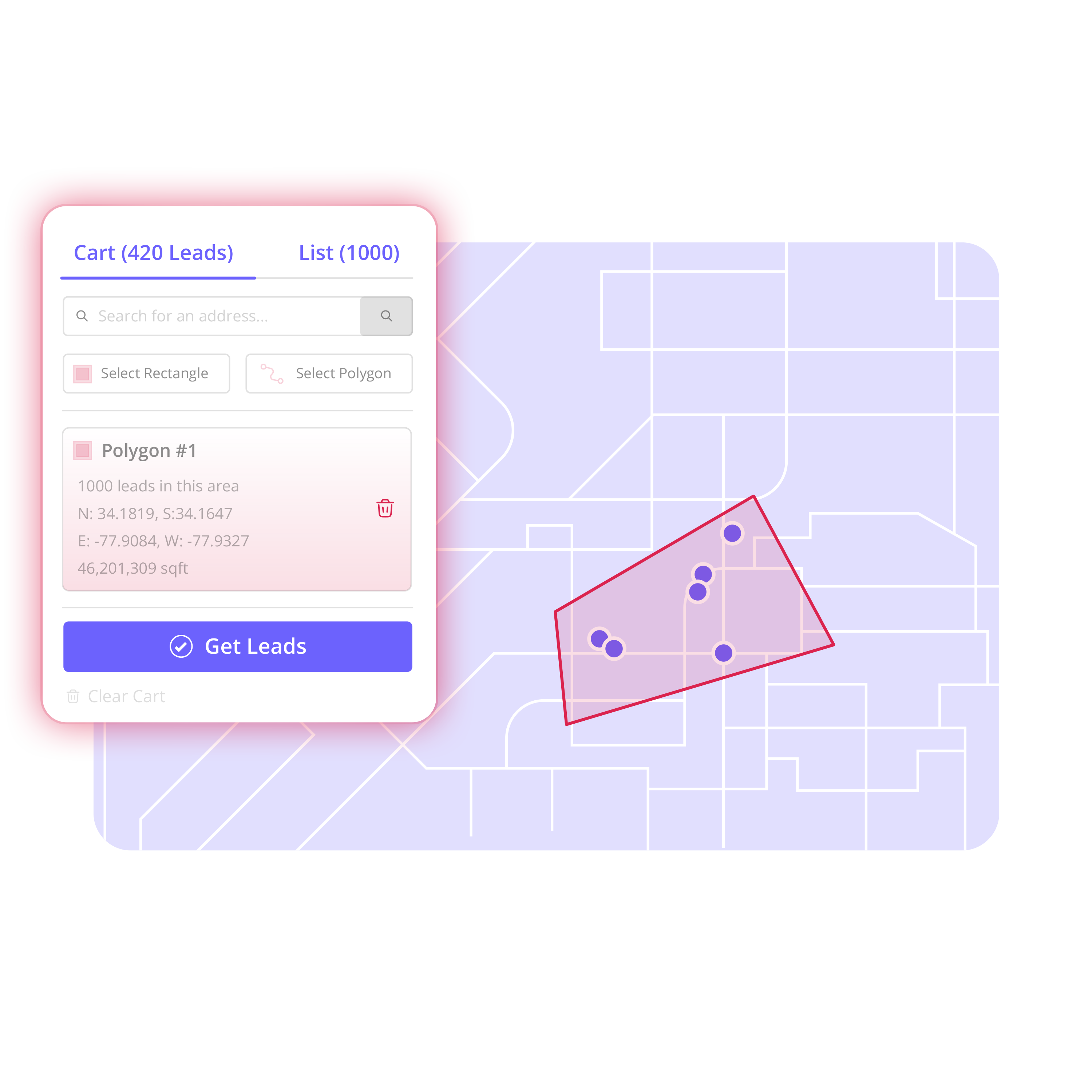
Avoid drawing a large rectangle just because it is fast. Rectangles work well when the target area is truly grid-like, but they often pull in properties across barriers or outside the streets your team plans to work. Use a polygon when the campaign needs to follow an irregular subdivision, a storm path, or a cluster of streets around a job.
Build for the campaign, not for the map
A territory does not need to cover every nearby property. It needs to support a specific campaign.
For example, a roofing sales manager may draw the streets surrounding a newly installed roof, then exclude a commercial strip and an apartment complex the team does not pursue. A solar canvassing team might draw only the owner-occupied neighborhoods assigned to one crew. A real estate investor may focus on a handful of blocks where the acquisition team has an active strategy.
That level of control matters. Purchased lists often force teams to clean up records they never intended to contact. Starting with the neighborhood gives you a cleaner first cut because geography comes before data handling.
Keep the territory workable in one motion
There is no universal number of properties that makes a territory right. It depends on your sales motion, team size, available time, and whether the campaign includes door knocking, calling, direct mail, or a mix of channels.
Still, a useful test is straightforward: can one assigned person explain where the territory begins, where it ends, and what they are expected to do with it? If the answer is no, tighten the boundary or split it into smaller areas.
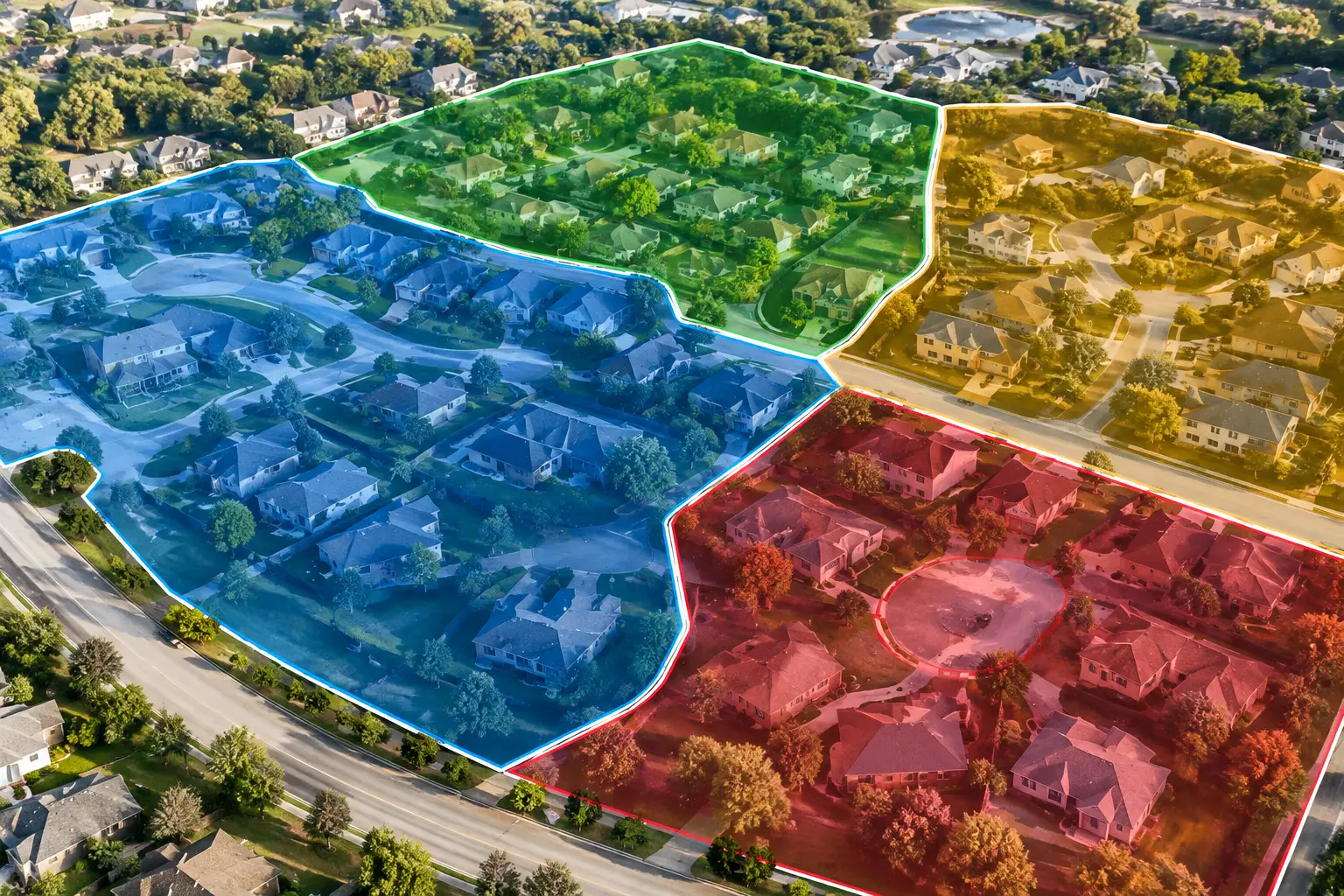
A large market can be broken into named territories such as North Ridge, Oak Street Corridor, or Jobsite 24 Surrounding Blocks. Clear names help managers assign work and help reps return to the same area without rebuilding the plan from scratch.
Turn the map into an organized prospect list
Drawing the boundary is the decision point. The next job is to turn that geography into a list your team can use.
With Territory, search the map, draw the area, and review the available property-based leads within the boundary. Select the properties that fit the campaign, then create an Audience for that group. From map to prospect list, the workflow stays tied to the territory your team chose.
Do not assume every property inside the shape should become a prospect. Review what is available and remove records that do not fit the campaign. You may exclude existing contacts, properties already assigned to another rep, addresses outside your service priorities, or property types your team does not pursue.
This is where geographic control prevents wasted work. Rather than exporting a broad raw file and sorting it later, you build the audience around the campaign before the list leaves the map.
Enrich only the records that matter
Once the Audience is built, add available homeowner or property-owner contact information to the records you intend to pursue. Build the territory first. Enrich what matters.
Selective enrichment keeps the campaign focused and helps avoid paying attention to records that will never be worked. It also gives the sales manager a chance to confirm the list, remove duplicates or out-of-scope properties, and decide which contacts deserve the next step.
Available contact details are prospecting data, not a signal that someone asked to be contacted. Teams should use their own compliance process and outreach standards for calls, email, mail, and in-person prospecting.
Assign ownership before outreach begins
A territory without ownership becomes a source of overlap. Assign the Audience or selected prospects to the right rep, crew, or manager before the campaign begins.
For a small roofing company, one rep may own the full jobsite territory. For a larger operation, a canvassing manager may divide one neighborhood into east and west sections, with separate assignees and statuses. The key is that the assignment follows a visible boundary, not an informal verbal agreement.
Use notes and activity records to keep the campaign organized as work starts. A lightweight prospecting workspace is enough for tracking who owns the contact, where the record stands, and what has happened so far. It does not need to replace the full CRM or operations systems your business already uses.
Common boundary mistakes that create bad campaigns
The most common mistake is defining a territory too broadly because it feels safer to have more names. More records do not automatically create a better campaign. A list spread across disconnected neighborhoods can slow down field work, blur accountability, and create more cleanup.
Another mistake is using only ZIP codes. ZIP codes can help identify a general market, but they rarely match how a rep canvasses or how a manager assigns a neighborhood. A ZIP may include commercial areas, subdivisions with different priorities, or sections far from a recent job.
Finally, do not let old spreadsheets control the territory. Imported records can be useful, especially when you need to see existing contacts on the map. But the map should help you decide where to work next. Your past data should inform the boundary, not dictate it.
A practical workflow for the next campaign
Start with the neighborhood, jobsite, service pocket, or expansion zone that matters now. Draw the streets your team intends to work. Select the properties that fit the campaign, create an Audience, and enrich the records worth pursuing.
Then assign clear ownership, organize the prospects by status, and export the campaign-ready data into the sales or outreach tools your team already uses. The result is not just a boundary on a map. It is a defined area, a usable list, and a team that knows what to do next.
The best boundaries make the next action obvious: choose a street, build the list, assign the work, and start the campaign.